• Home
  • About Us
  • Services
    • Wetland Delineation
    • Land Management >
      • Invasive Species Control
      • Pond Management
    • Environmental Monitoring
    • Mapping/GIS
    • Permitting
    • Listed Species Surveys >
      • Gopher Tortoise
      • Scrub Jay
      • Sand Skinks
    • Tree Surveys
    • Mitigation
    • Phase 1 ESA
  • Contact Us
  • Pricing
  • Testimonials
  • Recent Projects/Blog
Verde Environmental Co

Mapping/GIS ANalysis

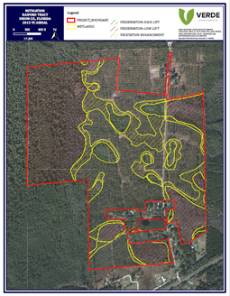
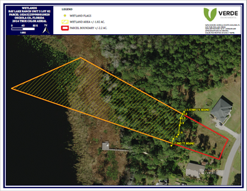
GIS Mapping & Data Collection


Aerial View of Environmental Protection Property
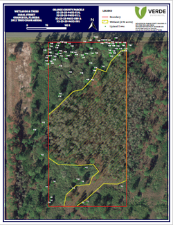
If you can think it up, Verde can most likely put it on a map for you.  We use GIS programs to overlay an assortment of data layers over aerial imagery.  Layers that we commonly use in our GIS analysis include soils, topo lines, GPS points and track logs, parcel boundaries, Lidar, historic aerials, and infrared imagery.  Additionally, there are countless geographic data sets that give us an enormous amount of information at our finger tips and the ability to display it on a map.  

Our most common maps include:
​-Wetland Maps
-County Tree Surveys
-Aerially Interpretations of Wetland Lines
-Mitigation Maps 
-Habitat Maps for Listed Species Surveys

Wetland Maps of Florida Land
GIS Mapping Service in Florida

We FIND THE BEST SOLUTIONS for our customers by providing Quality PLANS that DELIVER RESULTS.
​

Contact

Scott
​​Justin

Telephone

​​(352) 792-4757
​
(352) 317-1579

Email                                                Location

scott@verdeenv.com                              Ormond Beach, FL                 
​justin@verdeenv.com                             Gainesville, FL
  • Home
  • About Us
  • Services
    • Wetland Delineation
    • Land Management >
      • Invasive Species Control
      • Pond Management
    • Environmental Monitoring
    • Mapping/GIS
    • Permitting
    • Listed Species Surveys >
      • Gopher Tortoise
      • Scrub Jay
      • Sand Skinks
    • Tree Surveys
    • Mitigation
    • Phase 1 ESA
  • Contact Us
  • Pricing
  • Testimonials
  • Recent Projects/Blog